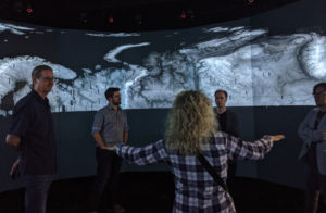
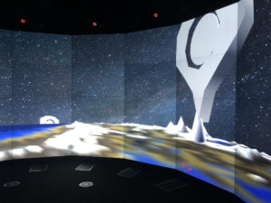
My colleague and I spent several weeks in Australia on a research exchange at the immersive visualization lab “The EPICentre” at the University of New South Wales. We spent our time learning to run interactive applications on their 52-projector immersive cylindrical CAVE system. We were able to create an application that loaded static digital elevation map-driven geometry, navigated around the curved Earth surface, dropped annotation symbols and text, record and edit camera paths, and evolve time steps.
My colleague focused on an application that could dynamically load the digital elevation map data directly, tiling the data and producing point clouds for on-the-fly exploration.
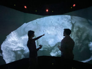
And just to better understand our dataset, I re-projected the original elevation map into a cylinder to display in the system’s native AxB resolution, giving a more comprehensive view than any desktop screen we’d used.